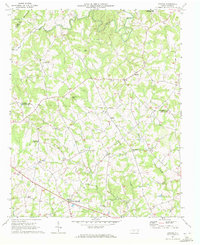
1970 Map of Banoak
USGS Topo · Published 1972About this map
The boundary between Burke and Catawba counties defines this rural Piedmont landscape, where small agricultural hubs like Cat Square and Hulls Crossroads serve as the primary points of commerce and community. The terrain is deeply etched by a network of waterways including Jacob Fork, Indian Creek, and Pott Creek, which separate rising landforms like Lynn Mtn and Brendle Mtn. These ridges and valleys are populated by a dense concentration of local landmarks, from North Brook Sch No 3 to numerous country congregations such as Corinth Ch, Palm Tree Ch, and Mulls Chapel. This 1970 snapshot preserves the spatial arrangement of these multi-generational family farming areas before modern development altered the rural character of the Catawba Valley.
Find a feature on this map
32 named features on this map. Tap any name to fly to it.
Don’t see what you’re looking for? This feature index may not catch every label — zoom into the map to look around manually.
Map Details
Editions of this 1970 Banoak Map
This is the sole edition of this map. No revisions or reprints were ever made.
Other maps of this area

1895 · Hickory
USGS Topo · 1:125,000

1905 · Morganton
USGS Topo · 1:125,000

1909 · Lincolnton
USGS Topo · 1:62,500

1911 · Lincolnton
USGS Topo · 1:62,500

1950 · Shelby
USGS Topo · 1:62,500

1953 · Charlotte
USGS Topo · 1:250,000

1954 · Charlotte
USGS Topo · 1:250,000

1956 · Valdese
USGS Topo · 1:24,000

1956 · Casar
USGS Topo · 1:24,000

1960 · Charlotte
USGS Topo · 1:250,000