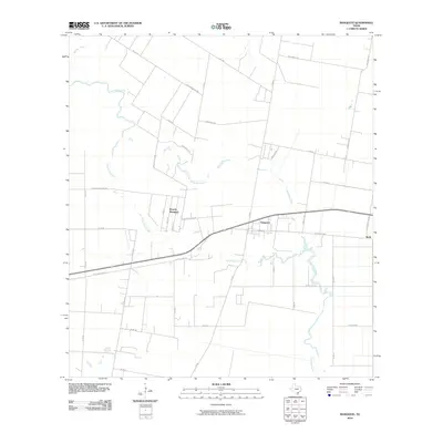
2010 Map of Banquete
USGS Topo · Published 2010About this map
Agua Dulce Creek meanders through the heart of the Coastal Bend, defining the agricultural landscape between the small communities of Banquete and Rabb. This 2010 survey shows a region deeply connected to its rural roots and transportation history, where Old State Hwy 44 and Old Robstown trace former thoroughfares across the Nueces County plains. To the west, the residential layout of Rancho Banquete sits adjacent to a network of family-named roads like Mantor Briggs Rd and Lian Hager Rd, reflecting the local landownership patterns of the era. The drainage of the land is meticulously documented via several waterways including Banquete Creek and Petronila Creek, which cut through the grid of county roads that serve the surrounding farmland.
Find a feature on this map
39 named features on this map. Tap any name to fly to it.
Don’t see what you’re looking for? This feature index may not catch every label — zoom into the map to look around manually.
Map Details
Editions of this 2010 Banquete Map
This is the sole edition of this map. No revisions or reprints were ever made.
Other maps of this area

1924 · Petronilla
USGS Topo · 1:62,500

1925 · Robstown
USGS Topo · 1:62,500

1950 · Corpus Christi
USGS Topo · 1:250,000

1954 · Orange Grove
USGS Topo · 1:62,500

1954 · Robstown
USGS Topo · 1:62,500

1954 · Kingsville
USGS Topo · 1:62,500

1954 · Petronila
USGS Topo · 1:62,500

1956 · Corpus Christi
USGS Topo · 1:250,000

1960 · Corpus Christi
USGS Topo · 1:250,000

1966 · Corpus Christi
USGS Topo · 1:250,000