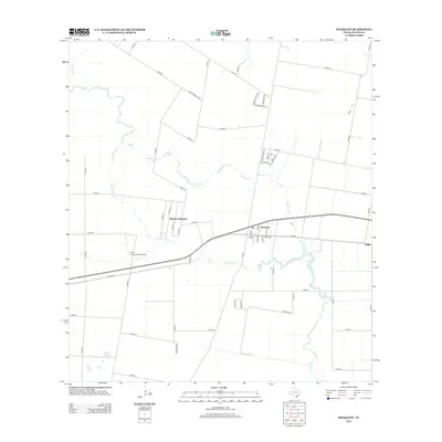
2013 Map of Banquete
USGS Topo · Published 2013About this map
Banquete and its neighboring residential hubs define the landscape of western Nueces County in this 2013 survey. The area shows a transition from structured town grids to the larger agricultural tracts typical of South Texas. The settlement of Rancho Banquete sits just west of the main town, while the small community of Rabb is situated to the east. A network of county roads, including Co Rd 48 and Co Rd 36, provides access to these rural holdings and ranch lands. Local aviation history is grounded at the Old Hoppe Place Airport, located south of the main highway. The natural geography is shaped by several drainages, most notably Agua Dulce Cr and Banquete Cr, which wind through the flat coastal plains. These waterways, along with Petronila Cr, remain central to the drainage and livestock operations that have long supported the local economy.
Find a feature on this map
54 named features on this map. Tap any name to fly to it.
Don’t see what you’re looking for? This feature index may not catch every label — zoom into the map to look around manually.
Map Details
Editions of this 2013 Banquete Map
This is the sole edition of this map. No revisions or reprints were ever made.
Other maps of this area

1924 · Petronilla
USGS Topo · 1:62,500

1925 · Robstown
USGS Topo · 1:62,500

1950 · Corpus Christi
USGS Topo · 1:250,000

1954 · Orange Grove
USGS Topo · 1:62,500

1954 · Robstown
USGS Topo · 1:62,500

1954 · Kingsville
USGS Topo · 1:62,500

1954 · Petronila
USGS Topo · 1:62,500

1956 · Corpus Christi
USGS Topo · 1:250,000

1960 · Corpus Christi
USGS Topo · 1:250,000

1966 · Corpus Christi
USGS Topo · 1:250,000