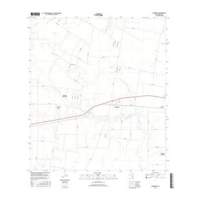
2016 Map of Banquete
USGS Topo · Published 2016About this map
Agua Dulce Creek meanders through this portion of Nueces County, shaping the landscape near the small community of Banquete. This map documents a region where rural residential growth and agriculture intersect, centered around the Rancho Banquete and Rabb settlements. One of the more distinct landmarks is the Old Hoppe Place Airport, a small private airstrip situated just west of the main Banquete townsite. The drainage patterns are clearly defined by several watercourses, including Petronila Creek and Banquete Cr, which flow through the southern and central portions of the quadrangle. The road network, composed of Farm to Market roads like FM 666 and various county roads, reflects the partitioned land use typical of this coastal prairie region, while the newer residential development at Spring Gardens appears in the southeast corner.
Find a feature on this map
47 named features on this map. Tap any name to fly to it.
Don’t see what you’re looking for? This feature index may not catch every label — zoom into the map to look around manually.
Map Details
Editions of this 2016 Banquete Map
This is the sole edition of this map. No revisions or reprints were ever made.
Other maps of this area

1924 · Petronilla
USGS Topo · 1:62,500

1925 · Robstown
USGS Topo · 1:62,500

1950 · Corpus Christi
USGS Topo · 1:250,000

1954 · Orange Grove
USGS Topo · 1:62,500

1954 · Robstown
USGS Topo · 1:62,500

1954 · Kingsville
USGS Topo · 1:62,500

1954 · Petronila
USGS Topo · 1:62,500

1956 · Corpus Christi
USGS Topo · 1:250,000

1960 · Corpus Christi
USGS Topo · 1:250,000

1966 · Corpus Christi
USGS Topo · 1:250,000