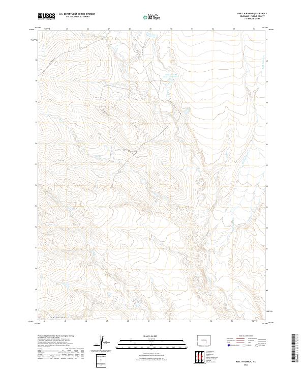
2022 Map of Bar J H Ranch
USGS Topo · Published 2022About this map
Tolle and Ditch Reservoir Number 1 and the winding course of Chico Cr anchor this high-plains landscape in Pueblo County. This 2022 survey documents a region defined by its drainage systems and ranching infrastructure, where water rights and access shape the land use. Seasonal waterways like Dry Cr, Andy Cr, and Burnt Cr carve intricate patterns across the terrain, converging toward the larger Black Squirrel Cr system. Local transport is facilitated by rural arteries such as Pexton Hwy and Apelt Ranch Rd, which provide access to the vast grazing lands. The topography is marked by notable depressions like Tom Hollow, illustrating the subtle yet complex relief of the Colorado prairie. This map offers a modern look at the continued importance of water management and traditional ranch boundaries in the contemporary American West.
Find a feature on this map
16 named features on this map. Tap any name to fly to it.
Don’t see what you’re looking for? This feature index may not catch every label — zoom into the map to look around manually.
Map Details
Editions of this 2022 Bar J H Ranch Map
This is the sole edition of this map. No revisions or reprints were ever made.
Other maps of this area

1891 · Pueblo
USGS Topo · 1:125,000

1891 · Nepesta
USGS Topo · 1:125,000

1893 · Nepesta
USGS Topo · 1:125,000

1893 · Big Springs
USGS Topo · 1:125,000

1893 · Colorado Springs
USGS Topo · 1:125,000

1894 · Pueblo
USGS Topo · 1:125,000

1896 · Pueblo
USGS Topo · 1:125,000

1897 · Pueblo
USGS Topo · 1:125,000

1904 · Nepesta
USGS Topo · 1:125,000

1909 · Colorado Springs
USGS Topo · 1:125,000