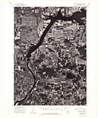
1974 Map of Baraboo SW
USGS Topo · Published 1976About this map
The Wisconsin River corridor serves as the central anchor of this 1974 orthophotoquad, where the landscape is clearly divided between riverine bottomlands and a highly organized patchwork of agricultural fields. Along the western bank, the settlement of Prairie Du Sac is captured at a moment of mid-century residential expansion, with its grid-like street pattern contrasting sharply against the irregular woodlands and steep bluffs that flank the river valley. The orthophoto format provides an exceptionally clear view of the land-use patterns of the era, revealing the exact footprints of farmsteads, the density of timber in the drainage ravines, and the industrial or utility installations situated near the water's edge. This specialized imagery allows for a precise study of how the community oriented itself around the river's path before later decades of development further altered the rural outskirts.
Find a feature on this map
2 named features on this map. Tap any name to fly to it.
Don’t see what you’re looking for? This feature index may not catch every label — zoom into the map to look around manually.
Map Details
Editions of this 1974 Baraboo SW Map
This is the sole edition of this map. No revisions or reprints were ever made.
Other maps of this area

1895 · Baraboo
USGS Topo · 1:62,500

1901 · Denzer
USGS Topo · 1:62,500

1907 · Cross Plains
USGS Topo · 1:62,500

1908 · Baraboo
USGS Topo · 1:62,500

1909 · Cross Plains
USGS Topo · 1:62,500

1920 · Blue Mounds
USGS Topo · 1:62,500

1922 · Blue Mounds
USGS Topo · 1:62,500

1957 · Madison
USGS Topo · 1:250,000

1958 · North Freedom
USGS Topo · 1:62,500

1959 · Baraboo
USGS Topo · 1:62,500