
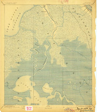
1892 Map of Barataria
USGS Topo · Published 1892About this map
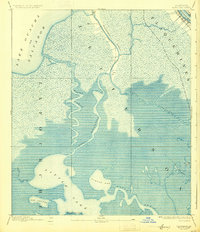
Barataria Bayou and the winding channels of the Mississippi Delta dominate this 1891 survey, illustrating a landscape defined by water and marsh before modern coastal erosion and engineering significantly altered these wetlands. At the northern edge, the settlement of Barataria sits along the waterway, while the N. O. F. J. & G. I. R. R. skirts the northeastern corner near the Mississippi River. The map meticulously details the complex hydrologic network of the era, from the wide expanse of Lake Ouacha or Salvador to the southern reaches of Little Lake. Local nomenclature is preserved through features like John the Fool Island, Turtle Bay, and the branching Bayou des Amoureux. This survey captures the intricate natural border between Jefferson, Lafourche, and Plaquemines parishes, documenting the primary transit routes through the Rigolettes and Bayou Perot during a period of heavy reliance on water-based travel.
Find a feature on this map
21 named features on this map. Tap any name to fly to it.
Don’t see what you’re looking for? This feature index may not catch every label — zoom into the map to look around manually.
Map Details
Editions of this 1892 Barataria Map
3 editions found
Other maps of this area

1891 · Hahnville
USGS Topo · 1:62,500

1891 · Pointe a La Hache
USGS Topo · 1:62,500

1891 · New Orleans
USGS Topo · 1:62,500

1892 · Cut-Off
USGS Topo · 1:62,500

1892 · Creole
USGS Topo · 1:62,500

1892 · St. Bernard
USGS Topo · 1:62,500

1892 · Pointe a La Hache
USGS Topo · 1:62,500

1893 · Fort Livingston
USGS Topo · 1:62,500

1894 · Lake Felicity
USGS Topo · 1:62,500

1932 · New Orleans SE
USGS Topo · 1:31,680