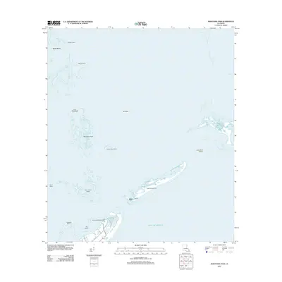
2012 Map of Barataria Pass
USGS Topo · Published 2012About this map
Isle Grande Terre and the surrounding marshy archipelagos of Jefferson Parish dominate this coastal survey. The landscape is defined by the shifting interface of land and water where the Gulf of Mexico meets Barataria Pass. Evidence of human industry and infrastructure is concentrated around the Grand Isle Seaplane Base and the eastern terminus of Humble Rd, while the Queen Bess Island Oil and Gas Field indicates the importance of maritime energy extraction in the early 21st century.
Find a feature on this map
26 named features on this map. Tap any name to fly to it.
Don’t see what you’re looking for? This feature index may not catch every label — zoom into the map to look around manually.
Map Details
Editions of this 2012 Barataria Pass Map
This is the sole edition of this map. No revisions or reprints were ever made.
Other maps of this area

1892 · Cheniere Caminada
USGS Topo · 1:62,500

1892 · Creole
USGS Topo · 1:62,500

1893 · Fort Livingston
USGS Topo · 1:62,500

1935 · Bay Ronquille
USGS Topo · 1:31,680

1935 · Wilkinson Bay
USGS Topo · 1:31,680

1945 · New Orleans
USGS Topo · 1:250,000

1947 · Caminada Pass
USGS Topo · 1:31,680

1947 · Bay Ronquille
USGS Topo · 1:31,680
1947 · Wilkinson Bay
USGS Topo · 1:31,680
1948 · Fort Livingston
USGS Topo · 1:62,500