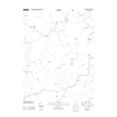
2013 Map of Barcreek
USGS Topo · Published 2013About this map
Barcreek and the surrounding hollows of Clay County are defined by a complex network of waterways including Goose Cr and the Red Bird River. This terrain is marked by numerous traditional gaps and hollows, such as Mountain Spring Gap and Big Graveyard Hollow, which illustrate the historical movement patterns through these Kentucky highlands. Small settlements like Hensley, Tanksley, and Hector are spaced along the creek beds, often situated near specific natural landmarks like Houchell Bend.
Find a feature on this map
84 named features on this map. Tap any name to fly to it.
Don’t see what you’re looking for? This feature index may not catch every label — zoom into the map to look around manually.
Map Details
Editions of this 2013 Barcreek Map
This is the sole edition of this map. No revisions or reprints were ever made.
Other maps of this area

1891 · Manchester
USGS Topo · 1:125,000

1952 · Hima
USGS Topo · 1:24,000

1952 · Manchester
USGS Topo · 1:24,000

1953 · Oneida
USGS Topo · 1:24,000

1953 · Big Creek
USGS Topo · 1:24,000

1953 · Mistletoe
USGS Topo · 1:24,000

1954 · Barcreek
USGS Topo · 1:24,000

1954 · Maulden
USGS Topo · 1:24,000
1954 · Ogle
USGS Topo · 1:24,000
1954 · Creekville
USGS Topo · 1:24,000