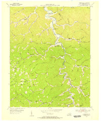
1954 Map of Creekville
USGS Topo · Published 1956About this map
The Red Bird River winds through the steep Cumberland Plateau terrain of Clay and Leslie Counties, anchoring a string of isolated communities and mountain schools in the mid-1950s. Small settlements like Creekville and Marcum are linked by narrow roads following the water gaps, where the local economy centered on early extraction efforts like the Strip Mine near Rocky Mtn. The map documents a dense network of rural education and faith, featuring numerous landmarks such as the Flat Creek Mission Ch, Double Creek Sch, and Lower Bluehole Sch.
Find a feature on this map
100 named features on this map. Tap any name to fly to it.
Don’t see what you’re looking for? This feature index may not catch every label — zoom into the map to look around manually.
Map Details
Editions of this 1954 Creekville Map
2 editions found
Other maps of this area

1886 · Cumberland Gap
USGS Topo · 1:125,000

1887 · Jonesville
USGS Topo · 1:125,000

1888 · Cumberland Gap
USGS Topo · 1:125,000

1891 · Manchester
USGS Topo · 1:125,000

1891 · Cumberland Gap
USGS Topo · 1:125,000

1891 · Hazard
USGS Topo · 1:125,000

1891 · Jonesville
USGS Topo · 1:125,000

1903 · Harlan
USGS Topo · 1:48,000

1903 · Pineville
USGS Topo · 1:48,000

1916 · Harlan
USGS Topo · 1:48,000