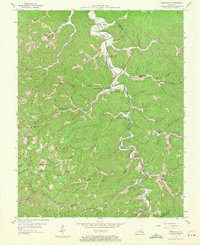
1954 Map of Creekville
USGS Topo · Published 1971About this map
The Red Bird River winds through the heart of the Clay and Leslie county borderlands, anchoring a landscape defined by deep hollows and narrow ridge-top settlements. In the mid-1950s, this area was a network of small, creek-side communities where life centered around neighborhood schools and local churches. From the Flat Creek Mission Ch at Creekville to remote outposts like Queendale, the map reveals a rural infrastructure built along watercourses such as Ashers Fork and Double Creek.
Find a feature on this map
75 named features on this map. Tap any name to fly to it.
Don’t see what you’re looking for? This feature index may not catch every label — zoom into the map to look around manually.
Map Details
Editions of this 1954 Creekville Map
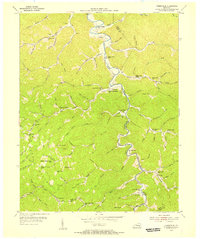
2 editions found
Other maps of this area

1886 · Cumberland Gap
USGS Topo · 1:125,000

1887 · Jonesville
USGS Topo · 1:125,000

1888 · Cumberland Gap
USGS Topo · 1:125,000

1891 · Manchester
USGS Topo · 1:125,000

1891 · Cumberland Gap
USGS Topo · 1:125,000

1891 · Hazard
USGS Topo · 1:125,000

1891 · Jonesville
USGS Topo · 1:125,000

1903 · Harlan
USGS Topo · 1:48,000

1903 · Pineville
USGS Topo · 1:48,000

1916 · Harlan
USGS Topo · 1:48,000