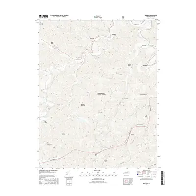
2016 Map of Barcreek
USGS Topo · Published 2016About this map
Daniel Boone National Forest dominates the interior of this 2016 survey, a landscape defined by the deep dissection of the Cumberland Plateau in Clay County. The terrain is a network of named hollows and ridges, where small settlements like Barcreek and Spurlock are situated along the lower elevations. The mapping of Little Graveyard Hollow and Big Graveyard Hollow points to the local burial sites that serve as vital touchstones for family historians in this part of Kentucky.
Find a feature on this map
39 named features on this map. Tap any name to fly to it.
Don’t see what you’re looking for? This feature index may not catch every label — zoom into the map to look around manually.
Map Details
Editions of this 2016 Barcreek Map
This is the sole edition of this map. No revisions or reprints were ever made.
Other maps of this area

1891 · Manchester
USGS Topo · 1:125,000

1952 · Hima
USGS Topo · 1:24,000

1952 · Manchester
USGS Topo · 1:24,000

1953 · Oneida
USGS Topo · 1:24,000

1953 · Big Creek
USGS Topo · 1:24,000

1953 · Mistletoe
USGS Topo · 1:24,000

1954 · Barcreek
USGS Topo · 1:24,000

1954 · Maulden
USGS Topo · 1:24,000
1954 · Ogle
USGS Topo · 1:24,000
1954 · Creekville
USGS Topo · 1:24,000