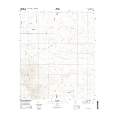
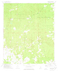
2015 Map of Barge Lake
USGS Topo · Published 2015About this map
The boundary between Winston Co and Noxubee Co defines the eastern edge of this landscape, where a dense network of creeks and drainage basins forms the headwaters of the regional river system. The terrain is notably marked by historical infrastructure and local landmarks, including the Barge Firetower Rd and the eponymous Barge Lake in the southern reaches. For genealogists and local historians, several community burial grounds are documented, such as Antioch Cem, Harrington Cem, and Sixteen Cem. The presence of Bombing Range Rd and Dummy Line Rd suggests a landscape once shaped by military activity and timber rail corridors. Water is a constant presence, with Loakfoma Cr, Yellow Cr, and Ball Ground Cr winding through the sections, often paralleled by rural routes like Louisville Brooksville Rd.
Find a feature on this map
42 named features on this map. Tap any name to fly to it.
Don’t see what you’re looking for? This feature index may not catch every label — zoom into the map to look around manually.
Map Details
Editions of this 2015 Barge Lake Map
This is the sole edition of this map. No revisions or reprints were ever made.
Other maps of this area

1953 · West Point
USGS Topo · 1:250,000

1958 · West Point
USGS Topo · 1:250,000

1959 · Artesia
USGS Topo · 1:62,500

1963 · West Point
USGS Topo · 1:250,000

1965 · Bluff Lake
USGS Topo · 1:24,000

1965 · Bradley
USGS Topo · 1:24,000
1973 · Boon
USGS Topo · 1:24,000
1973 · Fearns Springs
USGS Topo · 1:24,000
1973 · Barge Lake
USGS Topo · 1:24,000
1973 · Betheden
USGS Topo · 1:24,000