Old Maps of Winston County, Mississippi
Explore 119 old maps of Winston County, spanning from 1953 to today. These high-resolution historic maps reveal how streets, neighborhoods, landmarks, and natural features evolved over time — perfect for genealogy, metal detecting, research, and local history exploration.
What you can do with these maps:
- See how Winston County changed over time: Compare historical maps to modern-day views to trace roads, homesites, rail lines & more.
- View detailed metadata: Each map includes creators, publishers, year, scale, and archive source.
- Overlay maps with satellite & LiDAR: Visualize the past alongside modern tools to explore terrain & human change.
- Trusted historical sources: Maps sourced from the USGS, Library of Congress, and other archives.
- Access maps your way: View online, download high-res files, or order prints for personal or research use.
Start exploring old maps of Winston County to uncover forgotten places, hidden landmarks, and the deep history beneath your feet.
Winston County, MS maps
(119)- 1953 Map of Meridian, 1966 Print
 1953 Meridian1966 Print · USGSEast Central Mississippi and the Alabama borderlands are captured here during a period of steady growth and infrastructure expansion. Genealogists and historians can trace rail-town development along the Gulf Mobile & Ohio Railroad and find early settlements like Scooba, Pelahatchie, and De Kalb.2 unique versions available
 - 1953 Map of West Point, 1973 Print
 1953 West Point1973 Print · USGSNorth-Central Mississippi and the Alabama borderlands are captured here during the mid-twentieth century as new reservoirs and national forests transformed the landscape. Researchers can trace the path of the Mississippi & Skuna Valley railroad or locate old landings along the Tombigbee River and Schooner Creek.3 unique versions available
 - 1957 Map of Meridian
 1957 Meridian1957 Print · USGSEast Central Mississippi and parts of Western Alabama come alive in the mid-1950s, centered on the transit hub of Meridian. Researchers can trace old rail lines like the Illinois Central and find historic sites such as the Choctaw Indian Reservation and Roosevelt State Park.
 - 1958 Map of West Point
 1958 West Point1958 Print · USGSNortheastern Mississippi and western Alabama are shown in the late 1950s, highlighting a region defined by its river-and-rail economy. Researchers can trace family roots through numerous settlements like Artesia and Vardaman or explore the corridor of the Tombigbee River.
 - 1962 Map of Vernon, 1963 Print
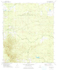
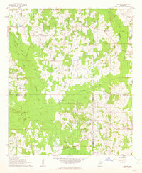 1962 Vernon1963 Print · USGSWinston and Neshoba Counties are captured in the early sixties, centered on rural communities and the significant Nanih Waiya Indian Mound. Researchers can trace local lineage through sites like Fulton Cem, Enon Ch, and Claytown.3 unique versions available
 - 1962 Map of Preston, 1963 Print
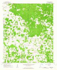 1962 Preston1963 Print · USGSThe tri-county borderlands of Winston, Noxubee, and Kemper counties are captured here in the early 1960s. Genealogists can locate family landmarks like Good Hope Ch, Hailey Cem, and the old schoolhouse at Preston.2 unique versions available
 - 1962 Map of Edinburg, 1964 Print
 1962 Edinburg1964 Print · USGSCentral Mississippi's rural river country comes to life in the early sixties, showing the intersection of four counties along the Pearl River. Genealogists can trace family roots through numerous sites like Battleground Cemetery, Coughlin Mound, and the settlement at Edinburg.
 - 1963 Map of West Point
 1963 West Point1963 Print · USGSEastern Mississippi and western Alabama are captured in the early sixties as industrial centers and rail lines connected the Black Prairie to the hills. Genealogists and historians can trace family-named watercourses and the early footprints of Starkville, Columbus, and the Noxubee National Wildlife Refuge.2 unique versions available
 - 1965 Map of Meridian
 1965 Meridian1965 Print · USGSEast Mississippi and West Alabama are mapped here in the mid-sixties as the region's modern highway and reservoir systems began to take shape. Researchers can trace rural lineages through local landmarks like Prince Chapel and Tuscahoma Landing, or follow the historic Gulf Mobile & Ohio rail lines.
 - 1965 Map of Bluff Lake, 1966 Print
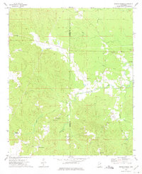
 1965 Bluff Lake1966 Print · USGSThe Oktibbeha County wetlands come into focus in the mid-sixties as conservation efforts shaped the local landscape. Genealogists and researchers can trace family landmarks like Bethel Ch and Noxubee Cem alongside the managed waters of Bluff Lake.
 - 1965 Map of Bradley, 1966 Print
 1965 Bradley1966 Print · USGSOktibbeha and Winston Counties are shown in the mid-1960s, a time when the rural landscape was defined by the Noxubee River and the Illinois Central railroad. Researchers can locate family landmarks like Pughs Mill Ch, McClelland Cem, and the old settlement of Bradley.3 unique versions available
 - 1972 Map of Louisville North, 1973 Print
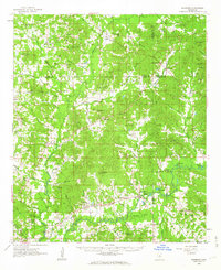
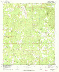
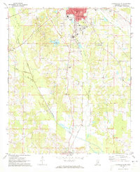
 1972 Louisville North1973 Print · USGSWinston County in the early 1970s shows a landscape balancing the Tombigbee National Forest with the industrial growth of Louisville. Trace family history at Noxubee Hill Cem or locate rural landmarks like Poplar Flat Ch and the McMillan settlement.2 unique versions available
 - 1972 Map of Highpoint, 1973 Print
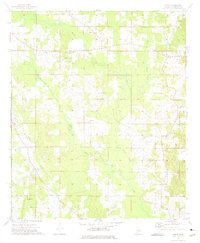
 1972 Highpoint1973 Print · USGSThe Choctaw and Winston county line in the early seventies shows a rural landscape of timberland and small parishes. Genealogists can trace several family burial sites and country churches including Old Concord Cem, Mt Nebo Ch, and Turner Cem.2 unique versions available
 - 1972 Map of Plattsburg, 1973 Print
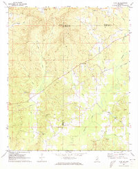
 1972 Plattsburg1973 Print · USGSThe Winston and Neshoba county line divides this Mississippi landscape in the early seventies, a region of family farms and creek bottoms. Genealogists can trace local heritage through numerous landmarks like Indian Spring Ch, Lee Cem, and Plattsburg.
 - 1972 Map of Ethel SE, 1973 Print
 1972 Ethel SE1973 Print · USGSWinston and Attala counties meet in this early 1970s survey, showing a landscape of timbered ridges and rural crossroads. Researchers can trace family history through a high density of local landmarks like Edgefield Ch, Rural Hill, and the McCool Lookout Tower.
 - 1972 Map of Noxapater, 1973 Print
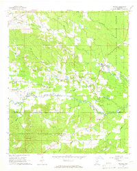
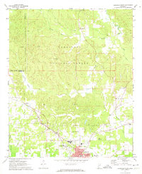
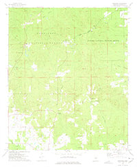
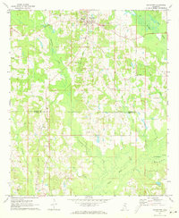 1972 Noxapater1973 Print · USGSWinston County's timber and rail landscape is well-preserved here in the early seventies, centered on the town of Noxapater. Genealogists and historians can trace local landmarks like Stallo, the Gulf Mobile and Ohio railroad, and country churches like Salem Ch.
 - 1972 Map of Louisville South, 1973 Print
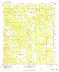
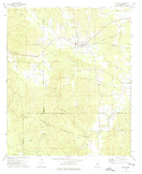
 1972 Louisville South1973 Print · USGSWinston County enters the 1970s as a landscape of established rail towns and rural church communities. Genealogists and local historians can trace family sites at Macedonia Cem and Johnson Cem, or locate landmarks like the Drive-in Theater and Eates.2 unique versions available
 - 1972 Map of Louisville SW, 1973 Print
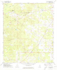 1972 Louisville SW1973 Print · USGSThe Winston and Choctaw county line in the early 1970s reveals a landscape defined by its rural churches and small-scale creek-side operations. You can locate family history sites like Whitehall Ch, Ford Community Center, and the Steed Cem along the Noxapater Creek drainage.2 unique versions available
 - 1972 Map of Sturgis, 1975 Print
 1972 Sturgis1975 Print · USGSThe town of Sturgis and its surrounding timberlands are captured here in the early seventies as the railroad still connected the local economy. Genealogists can trace family names through landmarks like Old Sturgis Cem, Boyd Chapel, and the Tombigbee Lookout Tower.
 - 1973 Map of Boon, 1975 Print
 1973 Boon1975 Print · USGSWinston County settlements and community churches are documented here in the early seventies, just after the photogrammetric surveys of the previous year. Researchers can trace the rural hubs of Boon and Cork, alongside numerous landmarks like Zion Chapel and the Claypit.2 unique versions available
 - 1973 Map of Fearns Springs, 1975 Print
 1973 Fearns Springs1975 Print · USGSWinston and Noxubee counties appear here in the early 1970s, a rural landscape defined by family settlements and an Old Railroad Grade. Genealogists can trace deep local roots at Hemphill Cem, Fearns Springs, and Little Member Ch.
 - 1973 Map of Barge Lake, 1975 Print
 1973 Barge Lake1975 Print · USGSWinston and Noxubee Counties are shown in the early seventies, a landscape defined by the wetlands of the Noxubee National Wildlife Refuge. Genealogists can locate family landmarks like Beth Cem, Conn Cem, and Antioch Ch.2 unique versions available
 - 1973 Map of Betheden, 1975 Print
 1973 Betheden1975 Print · USGSWinston County was a landscape of deep national forests and quiet rural hamlets during the early seventies. Genealogists can trace family roots through numerous country churches like Antioch Ch and cemeteries including Glenn Cem and Webster Cem.
 - 1984 Map of Carthage
 1984 Carthage1984 Print · USGSLeake and Neshoba counties in the mid-1980s showcase a transition from the Government Hills to the dense Bienville National Forest. Genealogists and researchers can trace the historic Natchez Trace Parkway and local settlements like Plattsburg and Williamsville.
 - 1984 Map of Kosciusko
 1984 Kosciusko1984 Print · USGSCentral Mississippi in the mid-eighties shows a landscape of timberlands and rural crossroads anchored by Kosciusko. Genealogists can trace family roots through numerous country parishes like Bethany Ch and Zion Ch or the path of the Illinois Central Gulf railroad.3 unique versions available
Showing maps 1-25 of 119
Top cities of Winston County
Frequently asked questions
- What are the different types of historical maps available for Winston County?
- What is the oldest map of Winston County?
- Where can I purchase historical maps of Winston County for my home or office?
- Where can I download high-res historical maps of Winston County?
- Are there historical topographic maps available for Winston County?
- Is there historical aerial imagery available for Winston County?
- Where are historical maps of Winston County sourced from?