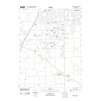
2011 Map of Bargersville
USGS Topo · Published 2011About this map
Bargersville and its surrounding Johnson County landscapes appear in high detail at the start of the 2010s, revealing a region defined by residential growth and enduring family landmarks. The area between Greenwood and Bargersville is densely partitioned into numerous named subdivisions such as Foxberry Trace, Brockton Manor, and Willow Lakes, reflecting a transition toward suburban settlement patterns. Despite this expansion, the map remains a critical resource for genealogists and local historians, meticulously documenting numerous burial grounds including Messersmith Cemetery, Mount Auburn Cemetery, and the Boles Cemetery near Old Bargersville.
Find a feature on this map
99 named features on this map. Tap any name to fly to it.
Don’t see what you’re looking for? This feature index may not catch every label — zoom into the map to look around manually.
Map Details
Editions of this 2011 Bargersville Map
This is the sole edition of this map. No revisions or reprints were ever made.
Other maps of this area

1942 · Franklin
USGS Topo · 1:125,000

1947 · Franklin
USGS Topo · 1:62,500

1948 · Franklin
USGS Topo · 1:24,000

1948 · Maywood
USGS Topo · 1:24,000

1948 · Beech Grove
USGS Topo · 1:24,000

1948 · Trafalgar
USGS Topo · 1:24,000

1950 · Franklin
USGS Topo · 1:62,500

1952 · Bargersville
USGS Topo · 1:24,000

1953 · Greenwood
USGS Topo · 1:24,000

1953 · Bridgeport
USGS Topo · 1:24,000