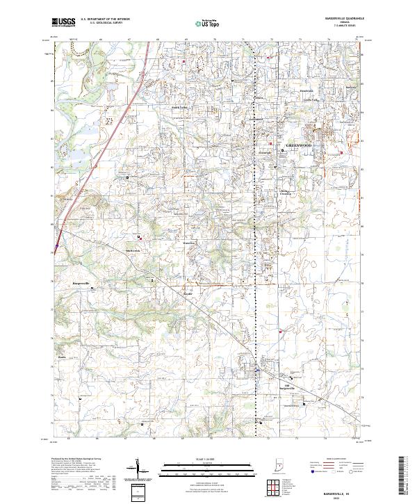
2022 Map of Bargersville
USGS Topo · Published 2022About this map
The White River forms a natural western boundary for this central Indiana landscape, where suburban growth from Greenwood meets long-established farming communities. The shift from rural to residential is evident in the transition from the cluster of original homesteads at Old Bargersville and Banta to the modern subdivisions of El Dorado and Critchfield. For genealogists, the map is remarkably dense with family-named burial sites, including the Messersmith Cem, Mallow Cem, and McColgin Cem, which anchor the histories of the surrounding townships.
Find a feature on this map
86 named features on this map. Tap any name to fly to it.
Don’t see what you’re looking for? This feature index may not catch every label — zoom into the map to look around manually.
Map Details
Editions of this 2022 Bargersville Map
This is the sole edition of this map. No revisions or reprints were ever made.
Historical Maps of McCarty Through Time
4 maps found