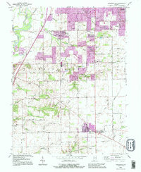
1992 Map of Bargersville
USGS Topo · Published 1995About this map
White River flows along the western edge of this central Indiana landscape, where the transition from river bottomlands to upland plateaus is defined by the winding paths of Honey Creek and Pleasant Run Creek. The 1992 revisions reveal the suburban expansion of Smith Valley and Bargersville, contrasting with the preserved rural character of nearby Old Bargersville. This layer of development over a traditional agricultural grid is marked by family-named landmarks like Sally Doty Hill and numerous small burial grounds, including the McColgin Cem and Boles Cem.
Find a feature on this map
81 named features on this map. Tap any name to fly to it.
Don’t see what you’re looking for? This feature index may not catch every label — zoom into the map to look around manually.
Map Details
Editions of this 1992 Bargersville Map
This is the sole edition of this map. No revisions or reprints were ever made.
Other maps of this area

1942 · Franklin
USGS Topo · 1:125,000

1947 · Franklin
USGS Topo · 1:62,500

1948 · Franklin
USGS Topo · 1:24,000

1948 · Maywood
USGS Topo · 1:24,000

1948 · Beech Grove
USGS Topo · 1:24,000

1948 · Trafalgar
USGS Topo · 1:24,000

1950 · Franklin
USGS Topo · 1:62,500

1952 · Bargersville
USGS Topo · 1:24,000

1953 · Greenwood
USGS Topo · 1:24,000

1953 · Bridgeport
USGS Topo · 1:24,000