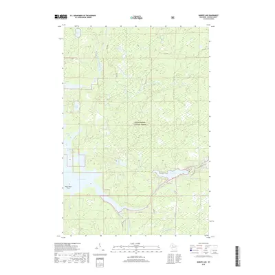
2018 Map of Barker Lake
USGS Topo · Published 2018About this map
The confluence of the East Fork Chippewa River and the West Fork Chippewa River defines this northern Wisconsin landscape, where the waters flow into the expansive Lake Chippewa. Large portions of the terrain are preserved within the Chequamegon National Forest, characterized by a dense network of glacial lakes including Beaver Lake, Tamarack Lake, and Venison Lake. The area's water-focused geography is highlighted by features such as Wagon Wheel Island and the constricted passage at Cranberry Narrows. Local infrastructure is concentrated along the southern portion of the quadrangle, with Co Hwy W and Co Rd B providing access to seasonal residences and recreational sites near Barker Lake. The presence of Venison Spring and various named creeks like Weasel Creek suggest a well-watered wilderness primarily utilized for timber and outdoor recreation by the early twenty-first century.
Find a feature on this map
33 named features on this map. Tap any name to fly to it.
Don’t see what you’re looking for? This feature index may not catch every label — zoom into the map to look around manually.
Map Details
Editions of this 2018 Barker Lake Map
This is the sole edition of this map. No revisions or reprints were ever made.
Other maps of this area

1942 · Clam Lake
USGS Topo · 1:48,000

1943 · Namekagon Lake
USGS Topo · 1:48,000

1944 · Draper
USGS Topo · 1:48,000

1944 · Radisson
USGS Topo · 1:48,000

1945 · Namekagon Lake
USGS Topo · 1:48,000

1945 · Clam Lake
USGS Topo · 1:48,000

1947 · Draper
USGS Topo · 1:48,000

1949 · Radisson
USGS Topo · 1:48,000

1953 · Ashland
USGS Topo · 1:250,000

1953 · Rice Lake
USGS Topo · 1:250,000