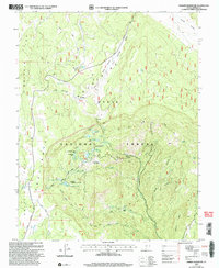
2002 Map of Barker Reservoir
USGS Topo · Published 2005About this map
High-elevation water management and forest service history define this part of the Dixie National Forest in Garfield County. The terrain is dominated by Griffin Top and Escalante Top, a high plateau landscape where natural drainages like Antimony Creek and North Creek are supplemented by a complex network of man-made irrigation features. The concentration of reservoirs, including Barker Reservoir, Joe Lay Reservoir, and Tall Four Reservoir, reflects the vital role of upland water storage for the surrounding valley communities. Historical forest management is marked by the Clayton Spring Guard Station (Site), while the Barker Complex serves as a modern operational hub. The presence of the Great Western Trail and numerous secondary paths like the Pacer Lake Trail indicates a landscape heavily utilized for both utility and recreation. This 2002 revision provides a look at the modern state of these high-altitude pastures and watershed protections.
Find a feature on this map
52 named features on this map. Tap any name to fly to it.
Don’t see what you’re looking for? This feature index may not catch every label — zoom into the map to look around manually.
Map Details
Editions of this 2002 Barker Reservoir Map
This is the sole edition of this map. No revisions or reprints were ever made.
Other maps of this area

1885 · Fish Lake
USGS Topo · 1:250,000

1886 · Escalante
USGS Topo · 1:250,000

1896 · Fish Lake
USGS Topo · 1:250,000

1956 · Escalante
USGS Topo · 1:250,000

1956 · Salina
USGS Topo · 1:250,000

1960 · Escalante
USGS Topo · 1:250,000

1960 · Salina
USGS Topo · 1:250,000

1962 · Salina
USGS Topo · 1:250,000

1964 · Griffin Point
USGS Topo · 1:24,000

1964 · Barker Reservoir
USGS Topo · 1:24,000