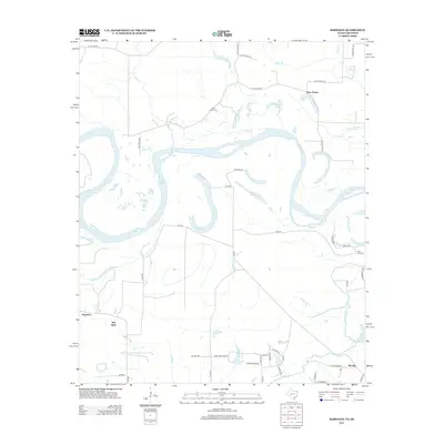
2013 Map of Barkman
USGS Topo · Published 2013About this map
The Red River meanders through this landscape where Arkansas and Texas meet, creating a complex network of oxbows and sloughs. Small rural communities like Barkman and Red Bank anchor the southern portion of the sheet, while Pine Prairie sits further north near the many branches of the Little River. The hydrology is particularly intricate here, with numerous named bodies of water such as Roseborough Lake, Old River Lake, and Scott Lake marking the ancient paths of the river system. Genealogists can identify localized landmarks such as Saint Lukes Cemetery and the River Plantation development near the banks of Barkman Creek. The map reflects a region defined by its fluvial history, where development follows the higher ground and follows a grid of farm-to-market roads and county lanes like FM-559 and Pearson Lane.
Find a feature on this map
56 named features on this map. Tap any name to fly to it.
Don’t see what you’re looking for? This feature index may not catch every label — zoom into the map to look around manually.
Map Details
Editions of this 2013 Barkman Map
This is the sole edition of this map. No revisions or reprints were ever made.
Other maps of this area

1909 · New Boston
USGS Topo · 1:62,500

1909 · Texarkana
USGS Topo · 1:62,500

1950 · Redbank
USGS Topo · 1:24,000

1950 · Ashdown East
USGS Topo · 1:24,000

1950 · Ashdown West
USGS Topo · 1:24,000

1950 · Ogden
USGS Topo · 1:24,000

1950 · Barkman
USGS Topo · 1:24,000

1951 · Redbank
USGS Topo · 1:24,000

1951 · Ashdown West
USGS Topo · 1:24,000

1951 · Ogden
USGS Topo · 1:24,000