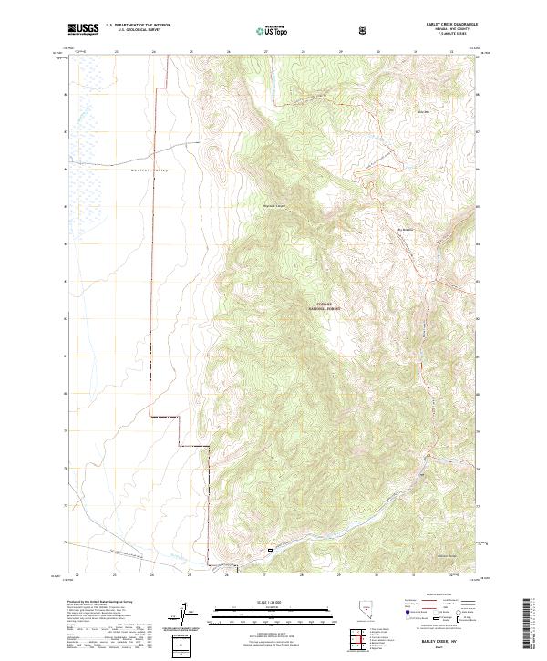
2021 Map of Barley Creek
USGS Topo · Published 2021About this map
Monitor Valley and the western slopes of the Monitor Range define this high-altitude landscape within the Toiyabe National Forest. The map documents a rugged transition between the wide alluvial valley floor and the steep, complex drainages of the range. Hydrological patterns are central to the area's layout, with South Fork Mosquito Creek and Barley Creek carving through the terrain. Human access is limited primarily to backcountry routes like the Barley Creek Trail and Barley Creek Ranch Road, which serves the few lower-elevation areas near the forest boundary. Natural landmarks such as Table Mountain, Big Meadow, and Dry Lake provide essential reference points for navigating this high-desert environment, where seasonal water sources like Meadow Creek and Cottonwood Creek dictate the historic and modern movement of people and livestock through Haystack Canyon.
Find a feature on this map
19 named features on this map. Tap any name to fly to it.
Don’t see what you’re looking for? This feature index may not catch every label — zoom into the map to look around manually.
Map Details
Editions of this 2021 Barley Creek Map
This is the sole edition of this map. No revisions or reprints were ever made.
Other maps of this area

1956 · Tonopah
USGS Topo · 1:250,000

1959 · Tonopah
USGS Topo · 1:250,000

1962 · Tonopah
USGS Topo · 1:250,000

1971 · Belmont East
USGS Topo · 1:24,000

1971 · Corcoran Canyon
USGS Topo · 1:24,000

1971 · Barley Creek
USGS Topo · 1:24,000
1971 · Elkhorn Canyon
USGS Topo · 1:24,000

1971 · Mosquito Creek
USGS Topo · 1:24,000
1971 · Green Monster Canyon
USGS Topo · 1:24,000
1971 · Danville
USGS Topo · 1:24,000