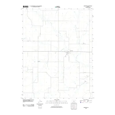
2010 Map of Barnard
USGS Topo · Published 2010About this map
Barnard serves as the primary hub in this portion of Lincoln County, situated along a network of creek drainages that define the local topography. The township layout is heavily influenced by the meandering paths of Salt Creek, Rattlesnake Creek, and Third Creek, which segment the agricultural landscape. For genealogists and local historians, several burial sites are documented across the rural outskirts, including Milo Cemetery to the northeast and Union Valley Cemetery near the center of the quadrangle. The road system follows a strict sectional grid, with local names like 220th Rd and Xray Dr connecting the outlying farms to the town center at Main St. In the southern reaches, the terrain is marked by the confluence of Prosser Creek and Battle Creek, showing the persistent importance of natural watercourses in shaping Kansas land division.
Find a feature on this map
22 named features on this map. Tap any name to fly to it.
Don’t see what you’re looking for? This feature index may not catch every label — zoom into the map to look around manually.
Map Details
Editions of this 2010 Barnard Map
This is the sole edition of this map. No revisions or reprints were ever made.
Other maps of this area

1892 · Minneapolis
USGS Topo · 1:125,000

1894 · Beloit
USGS Topo · 1:125,000

1952 · Glasco SW
USGS Topo · 1:24,000

1955 · Manhattan
USGS Topo · 1:250,000

1955 · Beloit
USGS Topo · 1:250,000

1956 · Manhattan
USGS Topo · 1:250,000

1957 · Manhattan
USGS Topo · 1:250,000

1959 · Beloit
USGS Topo · 1:250,000

1962 · Lincoln
USGS Topo · 1:24,000
1963 · Shady Bend
USGS Topo · 1:24,000