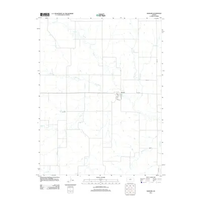
2012 Map of Barnard
USGS Topo · Published 2012About this map
Barnard sits at the heart of this North Central Kansas landscape, where the local street grid including Main St and White St meets the rural crossing of E Hwy-284. This 2012 survey illustrates a classic agricultural township structure, defined by a dense network of watercourses that drain the surrounding plains. The drainage pattern is led by Salt Creek and its many tributaries, such as Fifth Creek and Fourth Creek, which carve winding paths across the section lines.
Find a feature on this map
24 named features on this map. Tap any name to fly to it.
Don’t see what you’re looking for? This feature index may not catch every label — zoom into the map to look around manually.
Map Details
Editions of this 2012 Barnard Map
This is the sole edition of this map. No revisions or reprints were ever made.
Other maps of this area

1892 · Minneapolis
USGS Topo · 1:125,000

1894 · Beloit
USGS Topo · 1:125,000

1952 · Glasco SW
USGS Topo · 1:24,000

1955 · Manhattan
USGS Topo · 1:250,000

1955 · Beloit
USGS Topo · 1:250,000

1956 · Manhattan
USGS Topo · 1:250,000

1957 · Manhattan
USGS Topo · 1:250,000

1959 · Beloit
USGS Topo · 1:250,000

1962 · Lincoln
USGS Topo · 1:24,000
1963 · Shady Bend
USGS Topo · 1:24,000