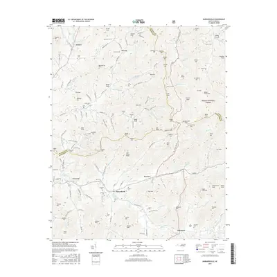
2016 Map of Barnardsville
USGS Topo · Published 2016About this map
Barnardsville and the surrounding coves of northern Buncombe County are defined by a complex network of mountain ridges and narrow creek valleys during the mid-2010s. The landscape is marked by numerous family and community burial grounds, including Marshbanks Cem and Antioch Cem, reflecting a long history of local settlement. The terrain transitions from the protected lands of the Pisgah National Forest in the east toward the valley communities of Democrat and Dillingham. Waterways such as Ivy Creek and Dillingham Creek dictate the layout of the road network, which winds through high-altitude gaps like Oldfield Gap and Moody Gap. This survey captures the rural character of the Big Ivy area, where ridges like Angel Ridge and Bearpen Ridge separate the various forks and branches that have sustained these mountain communities for generations.
Find a feature on this map
168 named features on this map. Tap any name to fly to it.
Don’t see what you’re looking for? This feature index may not catch every label — zoom into the map to look around manually.
Map Details
Editions of this 2016 Barnardsville Map
This is the sole edition of this map. No revisions or reprints were ever made.
Other maps of this area

1894 · Asheville
USGS Topo · 1:125,000

1900 · Mount Mitchell
USGS Topo · 1:125,000

1901 · Asheville
USGS Topo · 1:125,000

1902 · Mount Mitchell
USGS Topo · 1:125,000

1935 · Montreat
USGS Topo · 1:24,000

1935 · Black Brothers
USGS Topo · 1:24,000

1935 · Burnsville
USGS Topo · 1:24,000

1935 · Bald Creek
USGS Topo · 1:24,000

1935 · Barnardsville
USGS Topo · 1:24,000

1935 · Craggy Pinnacle
USGS Topo · 1:24,000