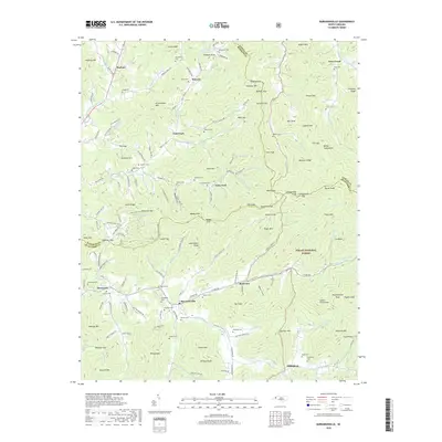
2019 Map of Barnardsville
USGS Topo · Published 2019About this map
Barnardsville serves as the focal point for this survey of the Blue Ridge mountain valleys in northern Buncombe County. The landscape is defined by the headwaters of Ivy Creek and its many tributaries, including Paint Fork and Dillingham Creek, which carve deep hollows between prominent peaks like Wildcat Mtn and Deweese Mtn. This area's settlement history is visibly etched into the terrain through a high density of family and community burial grounds, such as Antioch Cem near Democrat and the Marshbanks Cem situated beneath Grassy Knob. Much of the eastern portion of the map is preserved within the Pisgah National Forest, where the topography rises sharply toward Ingraham Mtn and the gaps that lead into neighboring Madison and Yancey counties. The network of rural roads follows these watercourses, connecting small mountain communities like Waverly and Rockview through a series of gaps and ridges.
Find a feature on this map
171 named features on this map. Tap any name to fly to it.
Don’t see what you’re looking for? This feature index may not catch every label — zoom into the map to look around manually.
Map Details
Editions of this 2019 Barnardsville Map
This is the sole edition of this map. No revisions or reprints were ever made.
Other maps of this area

1894 · Asheville
USGS Topo · 1:125,000

1900 · Mount Mitchell
USGS Topo · 1:125,000

1901 · Asheville
USGS Topo · 1:125,000

1902 · Mount Mitchell
USGS Topo · 1:125,000

1935 · Montreat
USGS Topo · 1:24,000

1935 · Black Brothers
USGS Topo · 1:24,000

1935 · Burnsville
USGS Topo · 1:24,000

1935 · Bald Creek
USGS Topo · 1:24,000

1935 · Barnardsville
USGS Topo · 1:24,000

1935 · Craggy Pinnacle
USGS Topo · 1:24,000