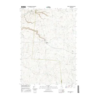
2016 Map of Barnes Corners
USGS Topo · Published 2016About this map
Barnes Corners sits at the junction of several rural routes along the Jefferson and Lewis County line, marking a landscape defined by significant geological incisions. The terrain is characterized by deep ravines known locally as gulfs, including Shingle Gulf, Bear Gulf, and Inman Gulf, where waterways like Sandy Creek and the Gulf Stream have carved through the upland. This 2016 survey documents the enduring layout of the Tug Hill plateau area, highlighting small settlements like East Rodman and Inman. Local history is anchored by sites such as the Saints Peter and Paul Cem and Newton Cem, while the road network, including the precisely named Mile Strip Rd and Seven By Nine Rd, reflects the original land surveying patterns of Northern New York.
Find a feature on this map
58 named features on this map. Tap any name to fly to it.
Don’t see what you’re looking for? This feature index may not catch every label — zoom into the map to look around manually.
Map Details
Editions of this 2016 Barnes Corners Map
This is the sole edition of this map. No revisions or reprints were ever made.
Other maps of this area

1895 · Watertown
USGS Topo · 1:62,500

1898 · Watertown
USGS Topo · 1:62,500

1902 · Carthage
USGS Topo · 1:62,500

1903 · Orwell
USGS Topo · 1:62,500

1904 · Carthage
USGS Topo · 1:62,500

1905 · Orwell
USGS Topo · 1:62,500

1906 · Highmarket
USGS Topo · 1:62,500

1908 · Watertown
USGS Topo · 1:62,500

1909 · Watertown
USGS Topo · 1:62,500

1942 · Copenhagen
USGS Topo · 1:24,000