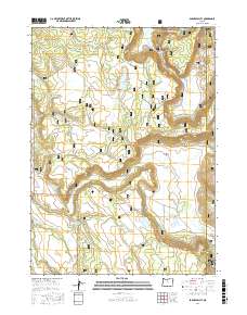
2017 Map of Barnes Valley
USGS Topo · Published 2017About this map
Fremont National Forest defines this high-desert drainage system in Barnes Valley, where early 21st-century water management is central to the landscape. The area is characterized by a complex network of springs and seasonal catchments, including Malloy Spring, Burnt Log Spring, and Pitch Log Spring, which feed into tributaries like Pitch Log Cr and Barnes Valley Cr. Large-scale water storage is evidenced by the Tull Reservoir and Little Squaw Flat Reservoir, reflecting the region's historical reliance on managed water for ranching or forestry. The terrain transitions between the open flats of Squaw Flat and Little Squaw Flat to the more varied topography of Bear Wallows near the Klamath and Lake county line. A dense grid of US Forest Service and BLM access roads connects these remote points, illustrating the modern management of public lands in this corner of Oregon.
Find a feature on this map
35 named features on this map. Tap any name to fly to it.
Don’t see what you’re looking for? This feature index may not catch every label — zoom into the map to look around manually.
Map Details
Editions of this 2017 Barnes Valley Map
This is the sole edition of this map. No revisions or reprints were ever made.
Other maps of this area

1889 · Klamath
USGS Topo · 1:250,000

1894 · Klamath
USGS Topo · 1:250,000

1955 · Klamath Falls
USGS Topo · 1:250,000

1958 · Klamath Falls
USGS Topo · 1:250,000

1960 · Gerber Reservoir
USGS Topo · 1:62,500

1960 · Bly
USGS Topo · 1:62,500

1960 · Strawberry Butte
USGS Topo · 1:62,500

1960 · Fishhole Mtn
USGS Topo · 1:62,500

1975 · Lakeview
USGS Topo · 1:100,000
1988 · Arkansas Flat
USGS Topo · 1:24,000