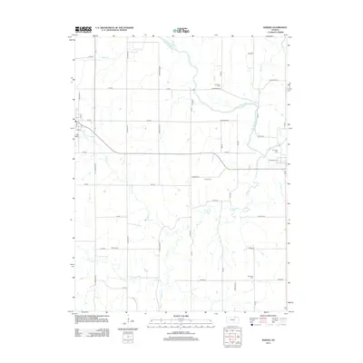
2012 Map of Barnes
USGS Topo · Published 2012About this map
The Little Blue River winds through this section of Marshall County, defining a landscape of agricultural grid roads and small rural intersections. The area is marked by several distinct family and community burial grounds, including Mound Cem and Harbaugh Cem, which serve as vital touchstones for genealogical research in this part of Kansas. A small cluster of development near S Main St and Center Blvd includes the local Po, acting as a central point for the surrounding farmsteads.
Find a feature on this map
47 named features on this map. Tap any name to fly to it.
Don’t see what you’re looking for? This feature index may not catch every label — zoom into the map to look around manually.
Map Details
Editions of this 2012 Barnes Map
This is the sole edition of this map. No revisions or reprints were ever made.
Other maps of this area

1889 · Marysville
USGS Topo · 1:125,000

1894 · Marysville
USGS Topo · 1:125,000

1955 · Manhattan
USGS Topo · 1:250,000

1956 · Manhattan
USGS Topo · 1:250,000

1957 · Manhattan
USGS Topo · 1:250,000

1966 · Marysville
USGS Topo · 1:24,000

1966 · Hanover SE
USGS Topo · 1:24,000

1966 · Hanover SW
USGS Topo · 1:24,000
1968 · Kimeo
USGS Topo · 1:24,000
1968 · Greenleaf
USGS Topo · 1:24,000