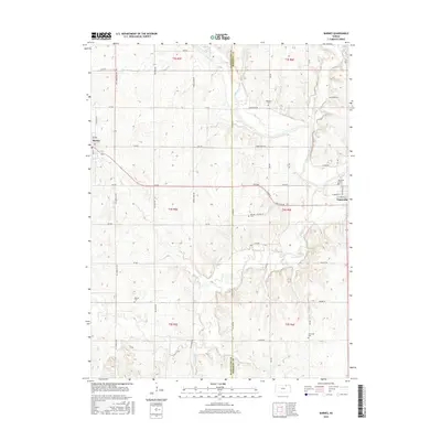
2016 Map of Barnes
USGS Topo · Published 2016About this map
The Little Blue River valley and its surrounding ridge lines define the landscape between Barnes and Waterville. This area of the Kansas plains, mapped in 2016, reveals a deeply dissected terrain shaped by several major drainages including Walnut Cr, Coon Cr, and Mercer Cr. The settlement patterns follow a rigid section-line grid of rural roads like All American Rd and Big Bear Rd, which traverse the high ground between the meandering creek beds.
Find a feature on this map
46 named features on this map. Tap any name to fly to it.
Don’t see what you’re looking for? This feature index may not catch every label — zoom into the map to look around manually.
Map Details
Editions of this 2016 Barnes Map
This is the sole edition of this map. No revisions or reprints were ever made.
Other maps of this area

1889 · Marysville
USGS Topo · 1:125,000

1894 · Marysville
USGS Topo · 1:125,000

1955 · Manhattan
USGS Topo · 1:250,000

1956 · Manhattan
USGS Topo · 1:250,000

1957 · Manhattan
USGS Topo · 1:250,000

1966 · Marysville
USGS Topo · 1:24,000

1966 · Hanover SE
USGS Topo · 1:24,000

1966 · Hanover SW
USGS Topo · 1:24,000
1968 · Kimeo
USGS Topo · 1:24,000
1968 · Greenleaf
USGS Topo · 1:24,000