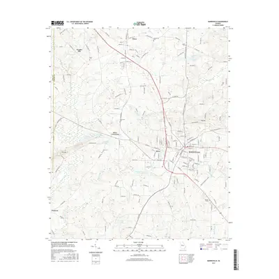
2017 Map of Barnesville
USGS Topo · Published 2017About this map
Barnesville and its surrounding Lamar County landscape are defined by a complex intersection of road networks and water systems, where the historic campus of Gordon Coll stands as a local landmark. The area transitions from the more densely settled corridors of Aldora and Milner to the outlying agricultural reaches of Piedmont and Woodfin Mill. This 2017 survey details a region marked by numerous small family and community burial sites, such as the Confederate Cem, Martin Cem, and Wadesworth Cem, which offer significant value for genealogical research. The hydrology of the quadrangle is intricate, featuring numerous engineered basins like Cannafax Lake Number 3 and McCord Lake, alongside natural watercourses such as Big Towaliga Creek and the headwaters of Potato Creek. These features illustrate the managed water resources common to middle Georgia's rolling terrain.
Find a feature on this map
172 named features on this map. Tap any name to fly to it.
Don’t see what you’re looking for? This feature index may not catch every label — zoom into the map to look around manually.
Map Details
Editions of this 2017 Barnesville Map
This is the sole edition of this map. No revisions or reprints were ever made.
Other maps of this area

1935 · Thomaston
USGS Topo · 1:48,000

1939 · Thomaston
USGS Topo · 1:62,500

1951 · Yatesville
USGS Topo · 1:62,500

1951 · Barnesville
USGS Topo · 1:62,500

1953 · Atlanta
USGS Topo · 1:250,000

1955 · Phenix City
USGS Topo · 1:250,000

1957 · Phenix City
USGS Topo · 1:250,000

1957 · Atlanta
USGS Topo · 1:250,000

1958 · Phenix City
USGS Topo · 1:250,000

1958 · Atlanta
USGS Topo · 1:250,000