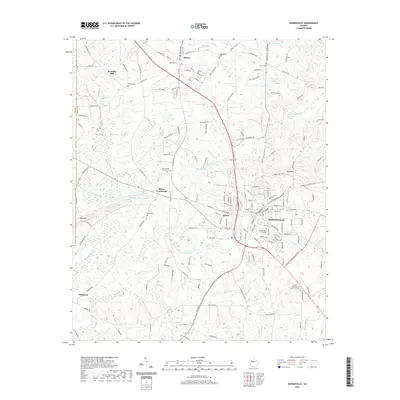
2020 Map of Barnesville
USGS Topo · Published 2020About this map
Barnesville serves as the central hub of this Lamar County landscape, anchored by the Lamar County Courthouse and the campus of Gordon State College. The town's grid expands outward toward the industrial and residential pockets of Aldora and nearby Milner Crossroads, showing a transition from dense municipal development to the structured agricultural and wooded tracts of the Georgia Piedmont. The geography is defined by a high concentration of water bodies, including Akin Lake, McCord Lake, and the extensive Camnaflax Lake Number 4, which feed into drainage systems like Potato Creek and Big Towaliga Creek.
Find a feature on this map
172 named features on this map. Tap any name to fly to it.
Don’t see what you’re looking for? This feature index may not catch every label — zoom into the map to look around manually.
Map Details
Editions of this 2020 Barnesville Map
This is the sole edition of this map. No revisions or reprints were ever made.
Other maps of this area

1935 · Thomaston
USGS Topo · 1:48,000

1939 · Thomaston
USGS Topo · 1:62,500

1951 · Yatesville
USGS Topo · 1:62,500

1951 · Barnesville
USGS Topo · 1:62,500

1953 · Atlanta
USGS Topo · 1:250,000

1955 · Phenix City
USGS Topo · 1:250,000

1957 · Phenix City
USGS Topo · 1:250,000

1957 · Atlanta
USGS Topo · 1:250,000

1958 · Phenix City
USGS Topo · 1:250,000

1958 · Atlanta
USGS Topo · 1:250,000