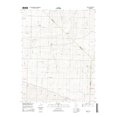
2015 Map of Barnett
USGS Topo · Published 2015About this map
Barnett and the surrounding agricultural lands of Morgan County define this landscape, where the town sits at the intersection of N Beacon Rd and Hope Rd. The area is characterized by a series of branching waterways, including Burris Fork and Gracey Cr, which have carved out distinct terrain features such as Routon Hollow. Smaller settlements like Excelsior are connected by a network of rural roads, including Mo-K and Excelsior Rd, reflecting the region's enduring farming heritage.
Find a feature on this map
46 named features on this map. Tap any name to fly to it.
Don’t see what you’re looking for? This feature index may not catch every label — zoom into the map to look around manually.
Map Details
Editions of this 2015 Barnett Map
This is the sole edition of this map. No revisions or reprints were ever made.
Other maps of this area

1888 · Versailles
USGS Topo · 1:125,000

1888 · Boonville
USGS Topo · 1:125,000

1893 · Versailles
USGS Topo · 1:125,000

1904 · Eldon
USGS Topo · 1:62,500

1904 · Gravois Mills
USGS Topo · 1:62,500

1935 · Gravois Mills
USGS Topo · 1:24,000

1935 · Rocky Mount
USGS Topo · 1:24,000
1935 · Eldon
USGS Topo · 1:24,000

1947 · Jefferson City
USGS Topo · 1:250,000

1949 · Gravois Mills
USGS Topo · 1:62,500