2024 Map of Barnett Shoals
USGS Topo · Published 2024About this map
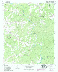
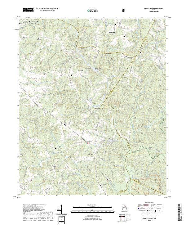
Barnetts Shoals and the surrounding rural landscapes of Oconee County are defined by the winding course of the Oconee River, which carves through the terrain to form Horseshoe Bend. This area, situated south of Athens, is characterized by a dense concentration of family and community burial grounds, such as Corinth Cem, Tuck Cem, and Big Creek Hardshell Cem, highlighting the deep ancestral roots in this region. The landscape transitions from the southern fringes of the city into the wooded reaches of the Oconee National Forest. Roadways like Elder Mill Rd and Barnett Shoals Rd connect small settlements such as Rose Hill and Elder, reflecting a long-standing agricultural and river-based economy. Numerous creeks, including Shoal Creek and Wildcat Creek, further divide the land, creating a network of small valleys and ridges like Coon Mtn.
Find a feature on this map
111 named features on this map. Tap any name to fly to it.
Don’t see what you’re looking for? This feature index may not catch every label — zoom into the map to look around manually.
Map Details
Editions of this 2024 Barnett Shoals Map
This is the sole edition of this map. No revisions or reprints were ever made.