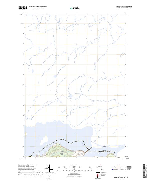
2023 Map of Barnhart Island
USGS Topo · Published 2023About this map
The Saint Lawrence River serves as the dominant geographical feature and international boundary on this modern topographical study of the New York borderlands. Centered on the intricate shoreline of Barnhart Island, the landscape is defined by the transition between the river's main channel and the northern reaches of New York. Recreational and access points such as Barnhart Island Beach and Massena Point are clearly delineated, connected by local routes including Barnhart Island Rd and Barnhart Isle. This survey illustrates the contemporary physical geography of the river system, documenting the land-to-water interface where the Canada United States of America border follows the deepest part of the waterway. The map provides a precise layout of the modern island infrastructure and hydrography within the St. Lawrence River valley.
Find a feature on this map
7 named features on this map. Tap any name to fly to it.
Don’t see what you’re looking for? This feature index may not catch every label — zoom into the map to look around manually.
Map Details
Editions of this 2023 Barnhart Island Map
This is the sole edition of this map. No revisions or reprints were ever made.
Other maps of this area

1906 · Massena
USGS Topo · 1:62,500

1907 · Massena
USGS Topo · 1:62,500

1915 · Moira
USGS Topo · 1:62,500

1917 · Moira
USGS Topo · 1:62,500

1942 · Barnhart Island
USGS Topo · 1:24,000

1942 · Massena
USGS Topo · 1:24,000

1943 · Barnhart Island
USGS Topo · 1:31,680
1943 · Massena
USGS Topo · 1:31,680

1944 · Moira
USGS Topo · 1:62,500
1946 · Raquette River
USGS Topo · 1:24,000