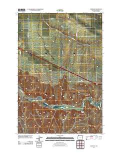
2011 Map of Barnhart
USGS Topo · Published 2011About this map
The Umatilla River valley defines the character of this 2011 survey, cutting through the landscape between the elevated Rieth Ridge and the southern drainage of Coombs Canyon. Small settlements like Barnhart and Campbell are situated near the river, reflecting the historical importance of the watercourse for transportation and agriculture in this portion of Umatilla County. The area is characterized by a network of established local roads, including Stage Gulch Rd and Yoakum Grade Rd, which connect the upland plateaus to the river basin.
Find a feature on this map
23 named features on this map. Tap any name to fly to it.
Don’t see what you’re looking for? This feature index may not catch every label — zoom into the map to look around manually.
Map Details
Editions of this 2011 Barnhart Map
This is the sole edition of this map. No revisions or reprints were ever made.
Other maps of this area

1908 · Umatilla
USGS Topo · 1:125,000

1935 · Pendleton
USGS Topo · 1:125,000

1953 · Pendleton
USGS Topo · 1:250,000

1956 · Pendleton
USGS Topo · 1:250,000

1962 · Stanfield SE
USGS Topo · 1:24,000

1966 · Mc Kay Reservoir
USGS Topo · 1:24,000

1966 · Holdman
USGS Topo · 1:24,000

1966 · Holdman SE
USGS Topo · 1:24,000

1966 · Pendleton
USGS Topo · 1:24,000
1966 · Barnhart
USGS Topo · 1:24,000