
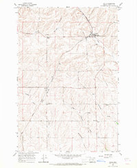
1966 Map of Holdman SE
USGS Topo · Published 1967About this map
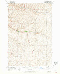
North Fork Cold Springs Canyon and its diverging branches define the landscape of this Umatilla County region during the mid-1960s. The topography is shaped by a complex system of drainage channels, including Middle Fork Cold Springs Canyon and South Fork Cold Springs Canyon, which converge in a predominantly agricultural upland. Local social and community life is anchored by a Grange Hall situated along the middle fork, while the small settlement at Kings Corner sits at a high point in the northeast. In the southern portion of the quadrangle, Missouri Gulch cuts through the terrain near the cluster of buildings at Cold Sprs. Evidence of local industry appears in the form of a Quarry tucked into the slopes of the south fork, illustrating the extraction of materials from these deep basaltic canyons.
Find a feature on this map
12 named features on this map. Tap any name to fly to it.
Don’t see what you’re looking for? This feature index may not catch every label — zoom into the map to look around manually.
Map Details
Editions of this 1966 Holdman SE Map
2 editions found
Other maps of this area

1935 · Pendleton
USGS Topo · 1:125,000

1953 · Pendleton
USGS Topo · 1:250,000

1956 · Pendleton
USGS Topo · 1:250,000
1966 · Juniper Canyon
USGS Topo · 1:24,000

1966 · Holdman
USGS Topo · 1:24,000
1966 · Smeltz
USGS Topo · 1:24,000

1966 · Pendleton
USGS Topo · 1:24,000

1966 · Mission
USGS Topo · 1:24,000
1966 · Ring
USGS Topo · 1:24,000
1966 · Helix
USGS Topo · 1:24,000