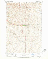
1966 Map of Holdman SE
USGS Topo · Published 1967About this map
North Fork Cold Springs Canyon, along with the Middle and South Forks, defines the drainage patterns of this Umatilla County landscape in the mid-1960s. The area is characterized by a network of deep-cut canyons and elevated plateaus, where small community landmarks like Kings Corner and two separate locations of Grange Hall appear as primary social and navigational nodes. These halls often served as the center of rural life for local farmers during this era. Evidence of early industry or road-building material is found at a Quarry near the South Fork Cold Springs Canyon, while the southwest corner is marked by the topographical feature of Missouri Gulch. The map reveals a highly structured agricultural or grazing environment, indicated by the extensive network of fence lines that cross the terrain between these canyons.
Find a feature on this map
8 named features on this map. Tap any name to fly to it.
Don’t see what you’re looking for? This feature index may not catch every label — zoom into the map to look around manually.
Map Details
Editions of this 1966 Holdman SE Map
2 editions found
Other maps of this area

1935 · Pendleton
USGS Topo · 1:125,000

1953 · Pendleton
USGS Topo · 1:250,000

1956 · Pendleton
USGS Topo · 1:250,000
1966 · Juniper Canyon
USGS Topo · 1:24,000

1966 · Holdman
USGS Topo · 1:24,000
1966 · Smeltz
USGS Topo · 1:24,000

1966 · Holdman SE
USGS Topo · 1:24,000

1966 · Pendleton
USGS Topo · 1:24,000

1966 · Mission
USGS Topo · 1:24,000
1966 · Ring
USGS Topo · 1:24,000