
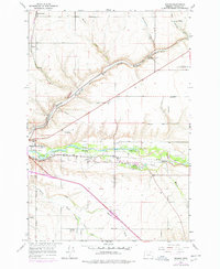
1966 Map of Mission
USGS Topo · Published 1967About this map
The Umatilla River valley defines the character of this mid-1960s landscape, serving as the corridor for both the Union Pacific and Northern Pacific railroads. The town of Mission serves as a central hub on the Umatilla Indian Reservation, housing the Indian Agency Hdqrs and the Indian Ceremonial Ground. Evidence of community life and history is scattered throughout, from the Rodeo Grounds near Munra to the Old Agency Cem and Tutuhilla Mission.
Find a feature on this map
37 named features on this map. Tap any name to fly to it.
Don’t see what you’re looking for? This feature index may not catch every label — zoom into the map to look around manually.
Map Details
Editions of this 1966 Mission Map
2 editions found
Other maps of this area

1935 · Pendleton
USGS Topo · 1:125,000

1953 · Pendleton
USGS Topo · 1:250,000

1956 · Pendleton
USGS Topo · 1:250,000

1966 · Cabbage Hill
USGS Topo · 1:24,000

1966 · Mc Kay Reservoir
USGS Topo · 1:24,000
1966 · Adams
USGS Topo · 1:24,000
1966 · Cayuse
USGS Topo · 1:24,000

1966 · Holdman SE
USGS Topo · 1:24,000

1966 · Table Rock
USGS Topo · 1:24,000

1966 · Pendleton
USGS Topo · 1:24,000