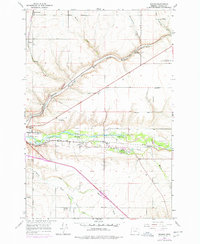
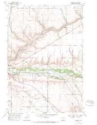
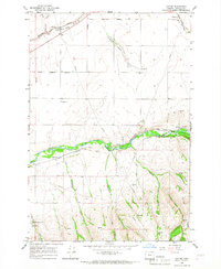
1966 Map of Mission
USGS Topo · Published 1978About this map
The Umatilla River valley serves as the central corridor of this 1960s landscape, which is heavily shaped by the administrative and cultural presence of the Umatilla Indian Reservation. The community of Mission acts as a primary hub, containing the Indian Agency Hdqrs and significant local landmarks like the Indian Ceremonial Ground Cem. Transport and utility infrastructure is prominent, with the Union Pacific and Burlington Northern railroads following the river's path, while an Old Indian Treaty Boundary and a Pipeline cut across the grain of the hills.
Find a feature on this map
36 named features on this map. Tap any name to fly to it.
Don’t see what you’re looking for? This feature index may not catch every label — zoom into the map to look around manually.
Map Details
Editions of this 1966 Mission Map
2 editions found
Other maps of this area

1935 · Pendleton
USGS Topo · 1:125,000

1953 · Pendleton
USGS Topo · 1:250,000

1956 · Pendleton
USGS Topo · 1:250,000
1966 · Cabbage Hill
USGS Topo · 1:24,000

1966 · Mc Kay Reservoir
USGS Topo · 1:24,000
1966 · Adams
USGS Topo · 1:24,000
1966 · Cayuse
USGS Topo · 1:24,000
1966 · Holdman SE
USGS Topo · 1:24,000
1966 · Table Rock
USGS Topo · 1:24,000
1966 · Pendleton
USGS Topo · 1:24,000