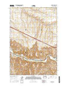
2017 Map of Barnhart
USGS Topo · Published 2017About this map
The Umatilla River winds through the southern reaches of this landscape, carving a fertile valley floor beneath the high plateaus of Umatilla County. The settlement of Rieth serves as a local anchor near the river's bend, where Rieth Bridge provides a critical crossing point. Further west along the river, the site of Barnhart marks a historic point in the drainage system, connected to the uplands by Barnhart Rd.
Find a feature on this map
28 named features on this map. Tap any name to fly to it.
Don’t see what you’re looking for? This feature index may not catch every label — zoom into the map to look around manually.
Map Details
Editions of this 2017 Barnhart Map
This is the sole edition of this map. No revisions or reprints were ever made.
Other maps of this area

1908 · Umatilla
USGS Topo · 1:125,000

1935 · Pendleton
USGS Topo · 1:125,000

1953 · Pendleton
USGS Topo · 1:250,000

1956 · Pendleton
USGS Topo · 1:250,000

1962 · Stanfield SE
USGS Topo · 1:24,000

1966 · Mc Kay Reservoir
USGS Topo · 1:24,000

1966 · Holdman
USGS Topo · 1:24,000

1966 · Holdman SE
USGS Topo · 1:24,000

1966 · Pendleton
USGS Topo · 1:24,000
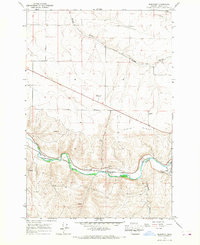
1966 · Barnhart
USGS Topo · 1:24,000