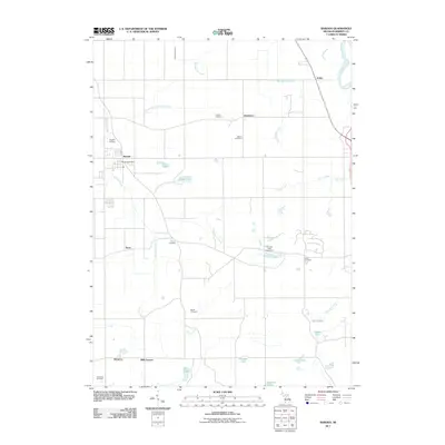
2011 Map of Baroda
USGS Topo · Published 2011About this map
Baroda serves as a central hub in this agricultural landscape, situated along the banks of Hickory Creek. The map documents a patchwork of family-named landmarks and small rural settlements like Glendora, Arden, and Hinchman, characteristic of Berrien County's interior. A notable concentration of historic burial grounds, including Ruggles Cemetery, Salem Cemetery, and Feather Cemetery, provides a rich resource for genealogical research and mapping early land ownership patterns. The terrain is defined by a complex drainage network, where the Saint Joseph River clips the northeastern corner and Lemon Creek meanders toward the center. This survey illustrates the relationship between the area's many small water bodies, such as Singer Lake and Boyle Lake, and the surrounding farmsteads and orchards that have long sustained the local economy.
Find a feature on this map
30 named features on this map. Tap any name to fly to it.
Don’t see what you’re looking for? This feature index may not catch every label — zoom into the map to look around manually.
Map Details
Editions of this 2011 Baroda Map
This is the sole edition of this map. No revisions or reprints were ever made.
Other maps of this area

1927 · Niles
USGS Topo · 1:62,500

1927 · Benton Harbor
USGS Topo · 1:62,500

1930 · Three Oaks
USGS Topo · 1:62,500

1930 · Benton Harbor
USGS Topo · 1:62,500

1930 · Niles
USGS Topo · 1:62,500

1943 · Niles
USGS Topo · 1:62,500

1944 · Three Oaks
USGS Topo · 1:62,500

1953 · Chicago
USGS Topo · 1:250,000

1957 · Chicago
USGS Topo · 1:250,000

1958 · Racine
USGS Topo · 1:250,000