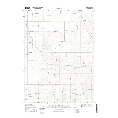
2014 Map of Baroda
USGS Topo · Published 2014About this map
The village of Baroda and the surrounding agricultural landscape of Berrien County are captured here in the early twenty-first century. This territory is defined by a dense network of country roads and the winding path of Hickory Cr, which drains the rolling fruit-growing region. Small settlements like Glendora, Hinchman, and Arden serve as local hubs, while numerous family-named burial grounds, such as Hinman Cem and Feather Cem, provide significant markers for genealogical research. The geography is punctuated by small glacial kettle lakes including Hess Lake, Singer Lake, and Boyle Lake, which are characteristic of the southwestern Michigan moraine. In the northeast, the Saint Joseph River cuts across the corner of the quadrangle, while the presence of Del Hickcox Airport northwest of Snow reflects the area's modern infrastructure within a traditionally rural setting.
Find a feature on this map
104 named features on this map. Tap any name to fly to it.
Don’t see what you’re looking for? This feature index may not catch every label — zoom into the map to look around manually.
Map Details
Editions of this 2014 Baroda Map
This is the sole edition of this map. No revisions or reprints were ever made.
Other maps of this area

1927 · Niles
USGS Topo · 1:62,500

1927 · Benton Harbor
USGS Topo · 1:62,500

1930 · Three Oaks
USGS Topo · 1:62,500

1930 · Benton Harbor
USGS Topo · 1:62,500

1930 · Niles
USGS Topo · 1:62,500

1943 · Niles
USGS Topo · 1:62,500

1944 · Three Oaks
USGS Topo · 1:62,500

1953 · Chicago
USGS Topo · 1:250,000

1957 · Chicago
USGS Topo · 1:250,000

1958 · Racine
USGS Topo · 1:250,000