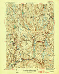
1946 Map of Barre
USGS Topo · Published 1946About this map
The Ware River and Burnshirt River carve through this central Massachusetts landscape, defining the industrial and social development of the mid-1940s. While Barre serves as the primary hub, the map reveals a series of specialized river-dependent settlements like South Barre, White Valley, and Coldbrook Springs. These communities are tightly integrated with the Boston and Albany and Boston and Maine rail lines, which follow the narrow valley floors to support local manufacturing and commerce.
Find a feature on this map
62 named features on this map. Tap any name to fly to it.
Don’t see what you’re looking for? This feature index may not catch every label — zoom into the map to look around manually.
Map Details
Editions of this 1946 Barre Map
2 editions found
Other maps of this area

1885 · Worcester
USGS Topo · 1:62,500

1886 · Worcester
USGS Topo · 1:62,500

1887 · Winchendon
USGS Topo · 1:62,500

1887 · Barre
USGS Topo · 1:62,500

1887 · Fitchburg
USGS Topo · 1:62,500

1889 · Fitchburg
USGS Topo · 1:62,500

1889 · Barre
USGS Topo · 1:62,500

1890 · Winchendon
USGS Topo · 1:62,500

1892 · Worcester
USGS Topo · 1:62,500

1893 · Fitchburg
USGS Topo · 1:62,500