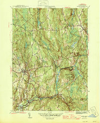
1946 Map of Barre
USGS Topo · Published 1946About this map
Barre and its neighboring villages in the mid-1940s define a landscape shaped by the Ware River and its critical water infrastructure. The confluence of the North Branch Ware River and West Branch Ware River south of Williamsville illustrates the region's industrial and hydro-geologic importance, further evidenced by the Intake Works and the underground path of the Quabbin Aqueduct. This engineering project, designed to facilitate water transport toward Boston, is shown traversing the southern part of the quadrangle near South Barre and Coldbrook Springs.
Find a feature on this map
53 named features on this map. Tap any name to fly to it.
Don’t see what you’re looking for? This feature index may not catch every label — zoom into the map to look around manually.
Map Details
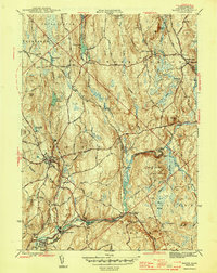
Editions of this 1946 Barre Map
2 editions found
Other maps of this area

1885 · Worcester
USGS Topo · 1:62,500

1886 · Worcester
USGS Topo · 1:62,500

1887 · Winchendon
USGS Topo · 1:62,500

1887 · Barre
USGS Topo · 1:62,500

1887 · Fitchburg
USGS Topo · 1:62,500

1889 · Fitchburg
USGS Topo · 1:62,500

1889 · Barre
USGS Topo · 1:62,500

1890 · Winchendon
USGS Topo · 1:62,500

1892 · Worcester
USGS Topo · 1:62,500

1893 · Fitchburg
USGS Topo · 1:62,500