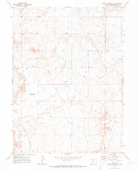
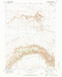
1970 Map of Barrel Springs SW
USGS Topo · Published 1973About this map
Seasonal drainage patterns and water management define this arid landscape in Sweetwater County during the late 1960s. The convergence of West Haystack Wash and East Haystack Wash into the primary Haystack Wash reveals how the topography directs runoff through the high desert basin. To support local ranching or resource needs, a series of small, named water features are distributed across the terrain, including Sand Branch Reservoir, N-T Res, and Cloud Res. These isolated reservoirs, along with Blank Res in the eastern sections, highlight the critical importance of water storage in an environment dominated by intermittent streams like Sand Creek. The map provides a clear record of these essential landmarks before subsequent changes in land use or drainage occurred in this portion of Wyoming.
Find a feature on this map
11 named features on this map. Tap any name to fly to it.
Don’t see what you’re looking for? This feature index may not catch every label — zoom into the map to look around manually.
Map Details
Editions of this 1970 Barrel Springs SW Map
This is the sole edition of this map. No revisions or reprints were ever made.
Other maps of this area

1954 · Rock Springs
USGS Topo · 1:250,000

1958 · Rock Springs
USGS Topo · 1:250,000

1962 · Rock Springs
USGS Topo · 1:250,000

1970 · Prehistoric Rim
USGS Topo · 1:24,000
1970 · Powder Mountain NE
USGS Topo · 1:24,000

1970 · Manuel Gap
USGS Topo · 1:24,000
1970 · Monument Valley
USGS Topo · 1:24,000

1970 · Fort La Clede NE
USGS Topo · 1:24,000
1970 · Salazar Butte
USGS Topo · 1:24,000
1970 · Haystack Flats
USGS Topo · 1:24,000