
1962 Map of Rock Springs
USGS Topo · Published 1962About this map
Rock Springs serves as the regional anchor on this mid-century survey, situated at a critical juncture of the Union Pacific railroad and the burgeoning highway system near Little America. The landscape is dominated by the high desert plateau of the Red Desert Basin and the striking volcanic features of the Leucite Hills, including Steamboat Mountain and North Table Mountain. Industrial activity is evident through numerous Gas wells dotting the North Baxter Basin and a Chemical Plant located west of the Green River.
Find a feature on this map
113 named features on this map. Tap any name to fly to it.
Don’t see what you’re looking for? This feature index may not catch every label — zoom into the map to look around manually.
Map Details
Editions of this 1962 Rock Springs Map
This is the sole edition of this map. No revisions or reprints were ever made.
Other maps of this area

1885 · Ashley
USGS Topo · 1:250,000

1885 · Uinta
USGS Topo · 1:250,000

1905 · Gilbert Peak
USGS Topo · 1:125,000

1906 · Gilbert Peak
USGS Topo · 1:125,000

1906 · Marsh Peak
USGS Topo · 1:125,000

1908 · Marsh Peak
USGS Topo · 1:125,000
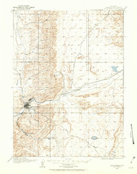
1908 · Rock Springs
USGS Topo · 1:62,500
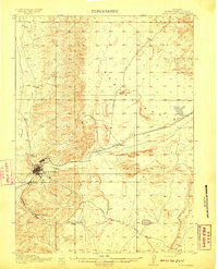
1910 · Rock Springs
USGS Topo · 1:62,500

1916 · Craig
USGS Topo · 1:125,000
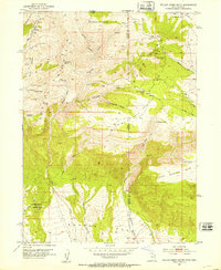
1952 · Willow Creek Butte
USGS Topo · 1:24,000