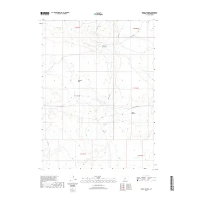
2017 Map of Barrel Springs
USGS Topo · Published 2017About this map
Barrel Springs and its surrounding high-desert drainage systems are the central focus of this Sweetwater County survey. The landscape is defined by its seasonal watercourses, with North Barrel Springs Draw and Wild Rose Draw cutting through the terrain toward the south. Access to this isolated region is primarily via unpaved corridors such as Delaney Rim Rd and Barrel Springs Rd, which serve the various Bureau of Land Management tracts. A network of secondary tracks, including Eureka Headquarters Rd and BLM Rd 4411, suggests a land use pattern typical of Wyoming's grazing and resource management districts. To the south, the terrain descends toward Shallow Cr and W Br Willow Cr, illustrating the subtle hydrological divide between these northern draws and the larger regional watersheds.
Find a feature on this map
20 named features on this map. Tap any name to fly to it.
Don’t see what you’re looking for? This feature index may not catch every label — zoom into the map to look around manually.
Map Details
Editions of this 2017 Barrel Springs Map
This is the sole edition of this map. No revisions or reprints were ever made.
Other maps of this area

1954 · Rawlins
USGS Topo · 1:250,000

1954 · Rock Springs
USGS Topo · 1:250,000

1958 · Rawlins
USGS Topo · 1:250,000

1958 · Rock Springs
USGS Topo · 1:250,000

1962 · Rawlins
USGS Topo · 1:250,000

1962 · Rock Springs
USGS Topo · 1:250,000

1966 · Eightmile Lake
USGS Topo · 1:24,000

1967 · Rawlins
USGS Topo · 1:250,000

1970 · South Barrel Spring
USGS Topo · 1:24,000

1970 · Red Desert SW
USGS Topo · 1:24,000