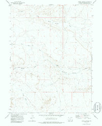
1970 Map of Barrel Springs
USGS Topo · Published 1985About this map
The Overland Trail cuts a historic path across this high desert landscape in Sweetwater County, marking the route used by countless emigrants and stagecoaches heading west. This 1970 field-checked survey highlights the arid geography of the Red Desert region, defined by an intricate system of seasonal watercourses such as Barrel Springs Draw and Wild Rose Draw. While the terrain appears stark, the presence of North Barrel Spring and a solitary Corral indicates the vital importance of water and livestock management in this open range. To the south, the drainage patterns shift toward West Branch Willow Creek and Shallow Creek, illustrating the subtle topographical divides of the Wyoming basin. This map serves as a precise record of the physical corridor and the sparse infrastructure that supported movement through this challenging territory.
Find a feature on this map
11 named features on this map. Tap any name to fly to it.
Don’t see what you’re looking for? This feature index may not catch every label — zoom into the map to look around manually.
Map Details
Editions of this 1970 Barrel Springs Map
This is the sole edition of this map. No revisions or reprints were ever made.
Other maps of this area

1954 · Rawlins
USGS Topo · 1:250,000

1954 · Rock Springs
USGS Topo · 1:250,000

1958 · Rawlins
USGS Topo · 1:250,000

1958 · Rock Springs
USGS Topo · 1:250,000

1962 · Rawlins
USGS Topo · 1:250,000

1962 · Rock Springs
USGS Topo · 1:250,000

1966 · Eightmile Lake
USGS Topo · 1:24,000

1967 · Rawlins
USGS Topo · 1:250,000

1970 · South Barrel Spring
USGS Topo · 1:24,000

1970 · Red Desert SW
USGS Topo · 1:24,000