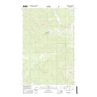
2017 Map of Barren Peak
USGS Topo · Published 2017About this map
Kootenai National Forest dominates this high-elevation landscape in Lincoln County, where the Cabinet Mountains' complex topography is defined by prominent divides and steep drainages. The map centers on the heights of Barren Peak and Teeters Peak, which serve as anchors for a network of forest service roads and backcountry routes. Water systems are particularly intricate here, with the Fisher River and Silver Butte Fisher River collecting flow from numerous tributaries like Schrieber Cr and W Fisher Cr.
Find a feature on this map
33 named features on this map. Tap any name to fly to it.
Don’t see what you’re looking for? This feature index may not catch every label — zoom into the map to look around manually.
Map Details
Editions of this 2017 Barren Peak Map
This is the sole edition of this map. No revisions or reprints were ever made.
Other maps of this area

1920 · Libby
USGS Topo · 1:125,000

1920 · Jennings
USGS Topo · 1:125,000

1930 · Libby
USGS Topo · 1:125,000

1932 · Libby
USGS Topo · 1:125,000

1932 · Trout Creek
USGS Topo · 1:125,000

1935 · Thompson Lakes
USGS Topo · 1:96,000

1935 · Trout Creek
USGS Topo · 1:125,000

1936 · Trout Creek
USGS Topo · 1:125,000

1937 · Thompson Falls
USGS Topo · 1:125,000

1942 · Thompson Lakes
USGS Topo · 1:125,000