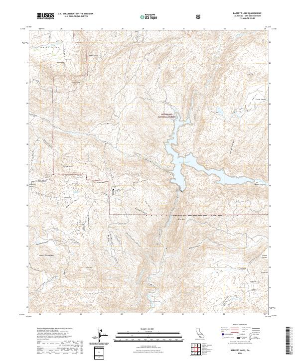
2021 Map of Barrett Lake
USGS Topo · Published 2021About this map
Barrett Lake serves as a central hydrological feature within the Cleveland National Forest, where the terrain is defined by steep canyons and prominent peaks. The map reveals a complex network of small settlements and named valleys, including Bratton Valley and Lawson Valley, which are connected by a web of truck trails and winding roads like Lyons Valley Rd. The presence of the San Diego City Conduit underscores the critical water management infrastructure required to sustain the region's scattered communities and agriculture. Local landmarks such as Mother Grundy Peak, Lawson Peak, and Gaskill Peak dominate the skyline, while the drainage of Cottonwood Cr and Wilson Cr carves out the surrounding landscape. This area, largely protected within the forest boundaries, preserves a distinct pattern of rural residency and rugged geography that has persisted into the modern era.
Find a feature on this map
71 named features on this map. Tap any name to fly to it.
Don’t see what you’re looking for? This feature index may not catch every label — zoom into the map to look around manually.
Map Details
Editions of this 2021 Barrett Lake Map
This is the sole edition of this map. No revisions or reprints were ever made.
Other maps of this area

1893 · El Cajon
USGS Topo · 1:62,500

1901 · Elcajon
USGS Topo · 1:62,500

1903 · Cuyamaca
USGS Topo · 1:125,000

1903 · Elcajon
USGS Topo · 1:62,500

1904 · Southern California Sheet No. 2
USGS Topo · 1:250,000

1939 · El Cajon
USGS Topo · 1:62,500

1942 · Potrero
USGS Topo · 1:48,000

1942 · El Cajon
USGS Topo · 1:62,500

1942 · Cuyamaca Peak
USGS Topo · 1:62,500

1943 · Jamul
USGS Topo · 1:62,500